
Terrains and Trains
Below we are proud to evidence our pupils’ work in Mapping and Direction this term. This highlights how we develop skills in map work so the children can begin to locate areas of study across the globe in relation to their local area.
Point to Point - EYFS
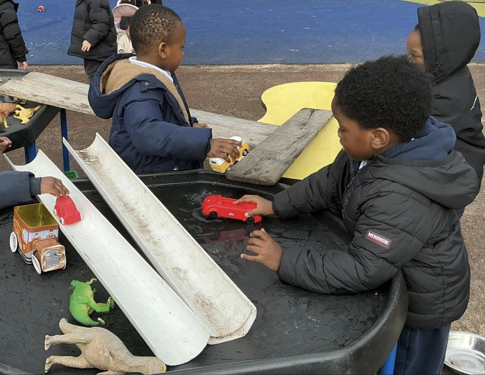
In free-flow play, the children transformed their outdoor space into a complex network of transportation and geography. By strategically positioning long white gutters and wooden planks, they began to grasp the fundamental concepts of spatial awareness and mapping. They weren't just moving toy cars and dinosaurs; they were intentionally designing routes to connect "point A" to "point B." As they navigated their toys down the ramps and across the water-filled tuff tray, they practiced predicting distances and understanding how different terrains—like the steep incline of a gutter versus the flat surface of a plank
Follow our Trail - KS1
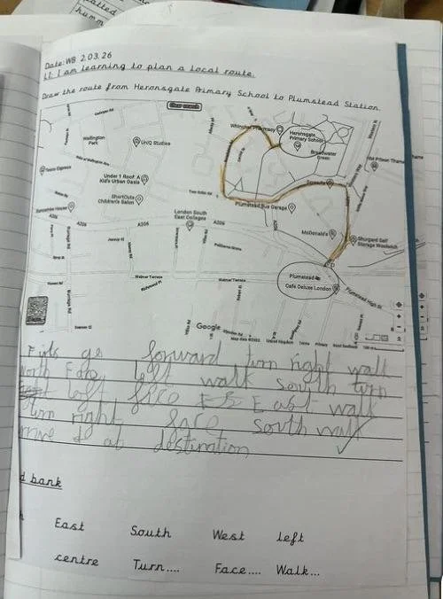
In Year 2, we have been been learning about direction and mapping. We have also been learning about compasses and using the vocabulary of North, East, South and West. We planned a route from our Primary School to Plumstead train station. Once we had planned the route, we then wrote out some instructions for people to follow.
Proximal Heirarchy - LKS2
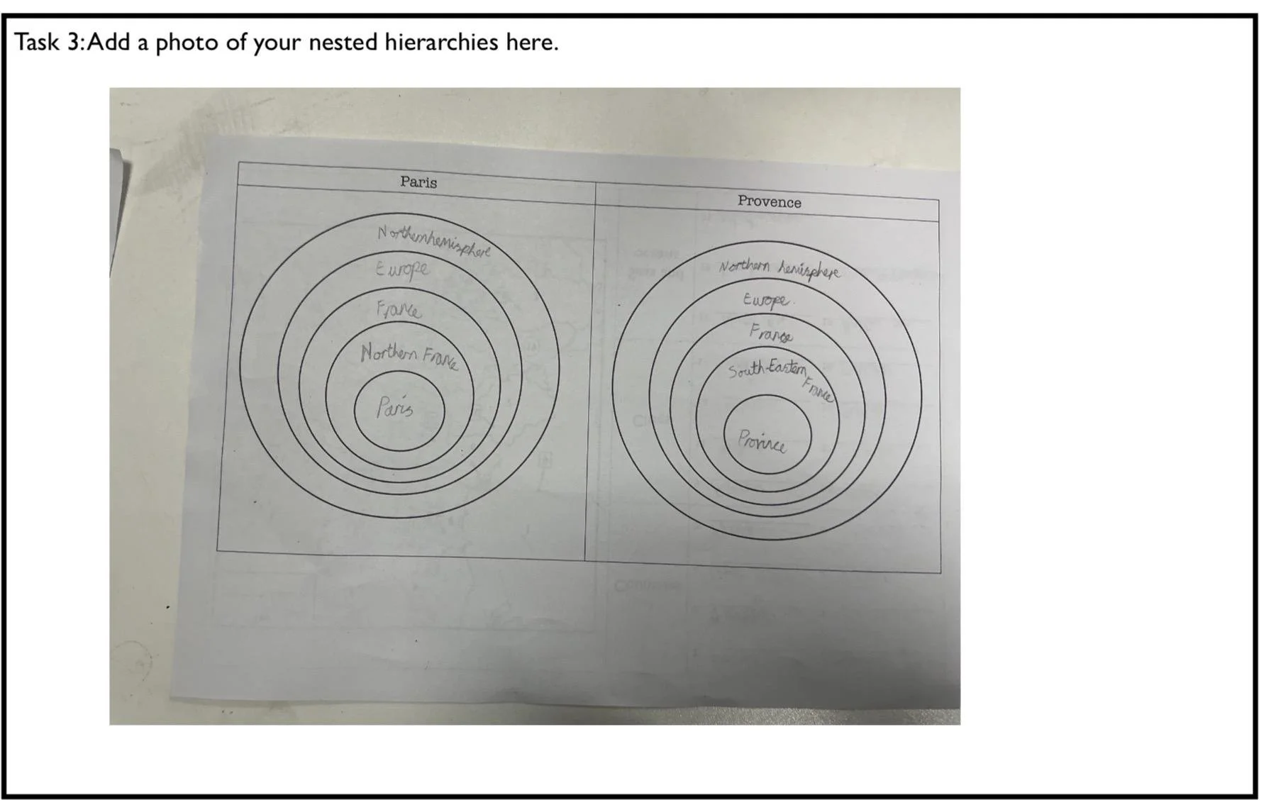
After using the atlas to locate various countries, seas and rivers in Europe, Year 4 zoomed in on France in particular. We used existing knowledge of compass points to describe the location of both Paris and Provence in a nested hierarchy. We compared this to our existing knowledge of the location of London and highlighted the similarities and differences.
Heights of Learning - UKS2
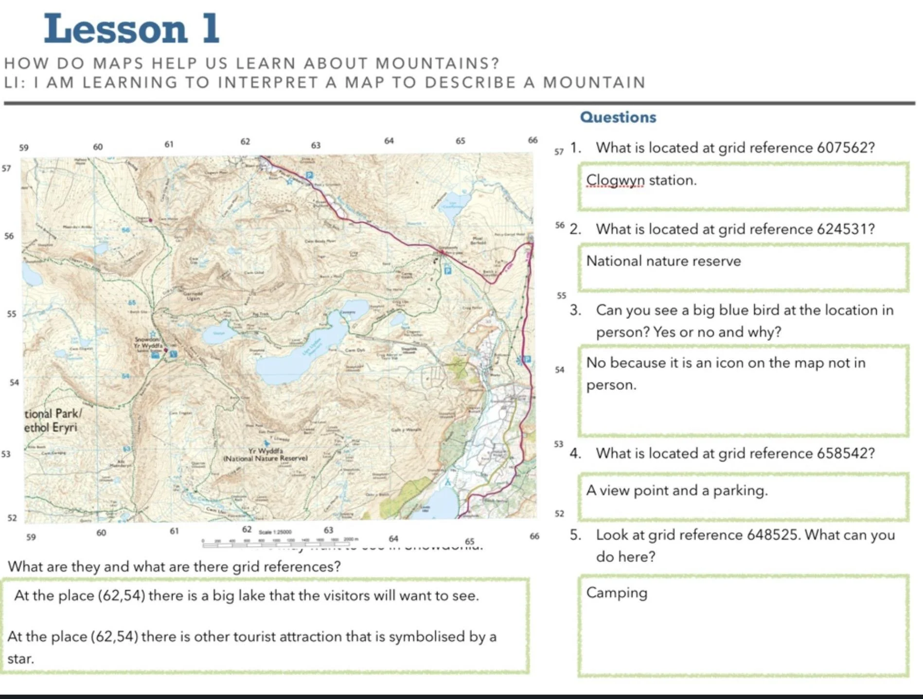
In Year 6, we learnt about how maps help us learn about mountains. We looked at how grid references help us locate specific areas on a map and what the icons on a map mean.