Meanings in Maps
We are proud to show our learning in regards to the area of Place Knowledge development this term below. This work is essential to achieving our geographical intent of securing high-quality fieldwork provision across the school. It allows children to study the human and physical geography of a locality first-hand—whether their own or another area—and subsequently compare it with a diverse contrasting region.
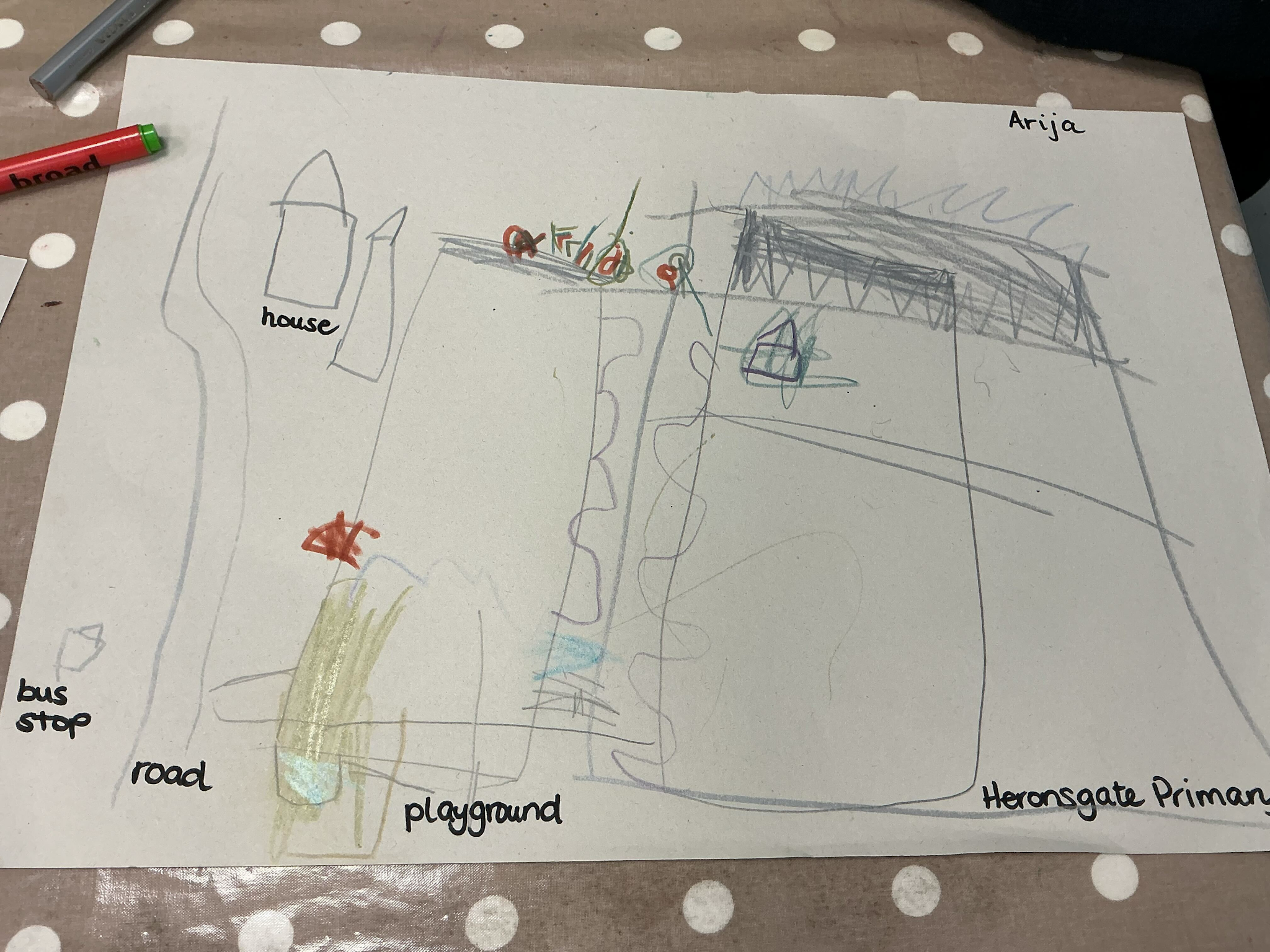
Cartography Children - EYFS
Reception children are currently learning about the local community and developing our vocabulary linked to the local area, such as roads, shops, schools. The children have created their own map of the local area - Heronsgate and the surrounding roads.
Putting Our School on the Map - KS1
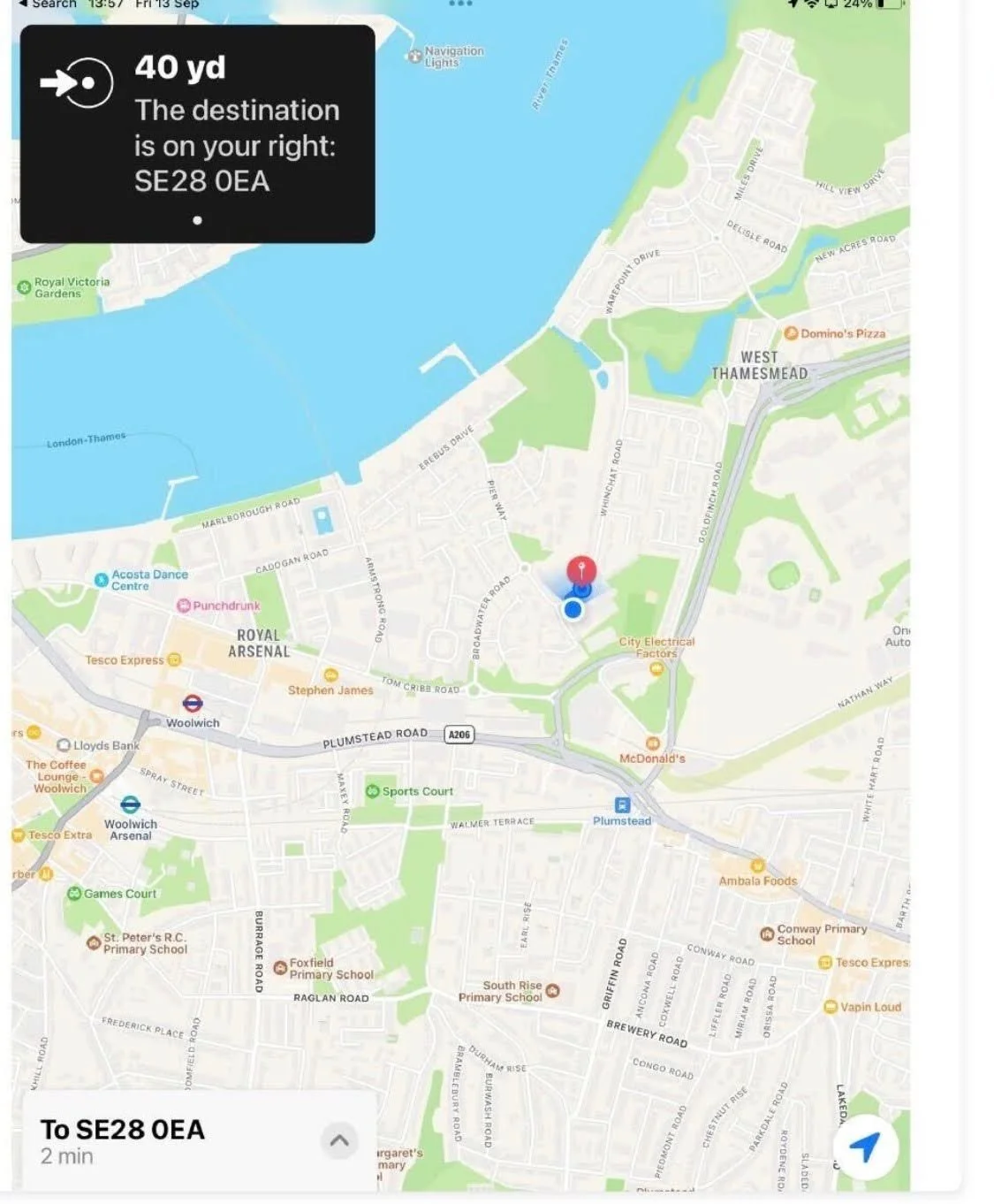
In Year 1, students learnt how to find their school on a map using the school’s postcode and street name. They explored Google Maps to locate where their school was and explored the surrounding area.
Stars and Stripes - LKS2
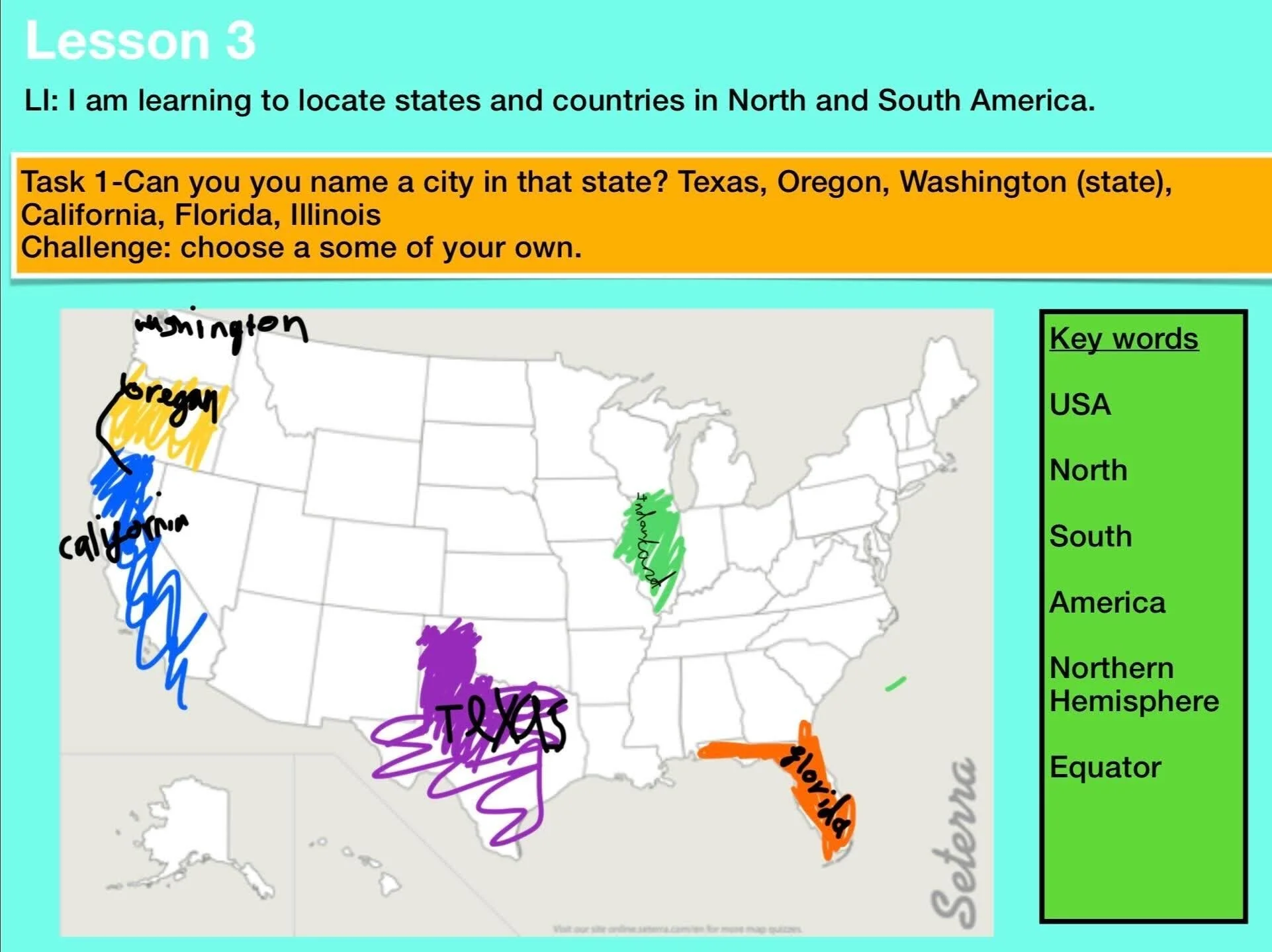
In Year 3, we have been learning about American states by locating them and other countries in North and South America on a map. We will also be comparing places in America and contrasting locations in the UK based on their uniqueness and what makes them special.
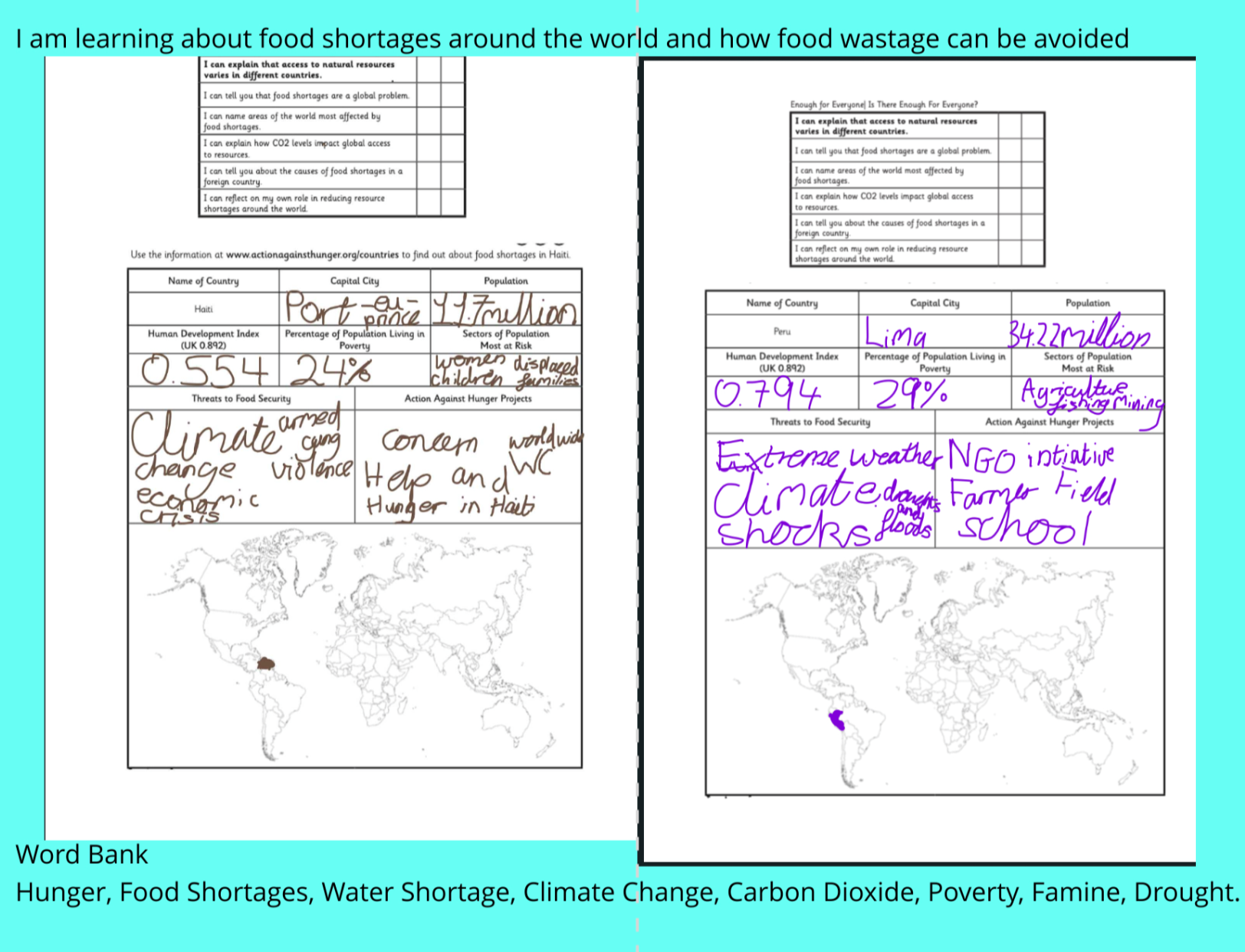
Scarcity and Waste - UKS2
In Year 5, students have been learning about climate and if there are enough resources for everyone. Students looked at how resources are used in different countries, food shortages and how food wastage can be avoided.